Where does the water of the Bai River come from?“Tracing the origination of Bai River”: A Journey to the Baiyun Mountain in Luoyang
Release time:2021-06-15 Reading times:
The Bai River is known as the mother river by Nanyang people. According to the Dictionary of Geographical Names of the People's Republic of China, Bai River, the main source of the Tang and Bai River, is located in the southwest of Henan Province and the north of Hubei Province. It was named Yu River in ancient times for its green water and abundance of white sand on the beach. Originating from the eastern foot of Yuhuangding, the main peak of Funiushan, it flows southeast and crosses the low mountainous hilly area on the south side of Funiushan, Song County, the reservoir at the mouth of Duck River in the east part of Nanzhao County. It then turns southward and flows into the Nanyang Basin, across Wolong District, Wancheng District and Xinye County in Nanyang City. Then it arrives in Zhaiwan in the east, and converges with the Tang River at Lianghekou in Hubei Province, forming the Tang and Bai River, which finally flows into the Han River, north of Xiangyang. However, where exactly is the main source of the Bai River?
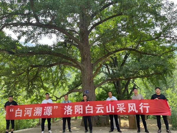
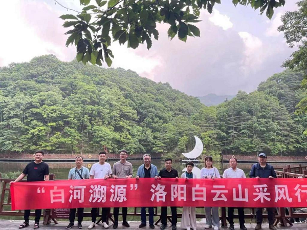
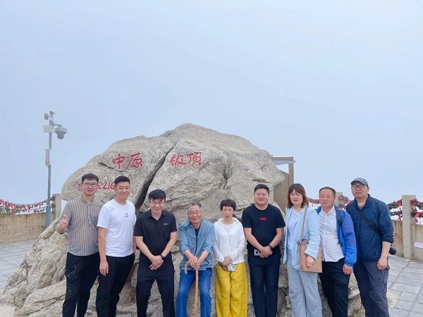
In June 2021, Funiushan UGGp and Baiyun Mountain Tourism Resort Co., Ltd. invited relevant geologists, foresters, cultural scholars, journalists and self-media celebrities to form a team of “A journey tracing the origination of the Bai River” to conduct scientific investigation. The team consisted of Zhang Tianyi, former associate dean and professor-level senior engineer of Land and Resources Scientific Research Institute of Henan Province, Qin Dapeng, chief of Resource Management Section of Nanyang Funiushan Global Geopark Management Committee, Gao Liuhui, director of Geopark Management Office of Song County Forestry Bureau, Li Deqiang, vice chairman of Photographers' Association of Nanzhao County, Yang Liu, anchor of Nanyang News Radio, and other people from Dawan.com and Nanyang City Association.
At 7 a.m. on June 11th, the team set off from Yuyang Bridge in Nanyang and arrived at Qiaoduan Town in Nanzhao County at around 9, then they started the retracing journey of entering the hinterland of Funiushan, crossing the Bai River Gorge and exploring the main source of the Bai River.
The first destination of the trip came to the thousand-year-old Yunyan Temple located in Xiasi Village, Song County, Luoyang City. Though the magnificent architecture groups in the ancient temple no longer exist, over 400 millennial ginkgo trees still stand tall and straight, growing up luxuriantly. In 2007, the ancient ginkgo forest there was listed in the Guinness Book of World Records as “the most thousand-year-old ginkgo trees in an ancient temple”.

The second destination lies in Baihe Town, which is located in the most southern part of Song County. Baihe Town is named after the geographic position where the Bai River originated. It is located in the hinterland of Funiushan, where the mainstream of the Bai River twists and turns and creates a small intermontane basin. Through Baihe Town, they continued to travel northwest for 5.8 kilometers, and two rivers were seen converged there. On map, the Dongqing River and Jiulong River of the upper reaches of Bai River meet here, hence the place is named Lianghekou. In order to trace the main source, the team followed the trickle of the Dongqing River up to the jade Paifang of Baiyun Mountain at an altitude of 1000 meters where it no longer flows. They then concluded that the river has a total length of about 15 kilometers with a flow rate of less than 0.05m3/s.
Afterwards, they returned to Lianghekou and traced forward along the Jiulong River. Through the aerial tramway of the Baiyun Mountain scenic spot, they arrived at the the Jiulong River Grand Canyon sightseeing area, the most wonderful part of Baiyun Mountain waters. Here, the canyon with a total length of 5 kilometers and a drop of 600 meters, and 18 diverse waterfalls form magnificent landscape groups. On the rock wall of the Jiulong Waterfall, nine distinct rock patterns are inlaid, resembling nine dragons frolicking in the waterfall. With a drop of 123 meters the torrent dashes down from high like the Milky Way pouring down. Rainbows appear in bright sunshine and move around people, which can be called the masterpiece among “Central Plains landscapes”.
The third destination of the journey is alpine lakes hidden in the primitive secondary forest of Baiyun Mountain. Baiyun Lake, with an altitude of 1500 meters above sea level and a maximum storage capacity of 120,000 cubic meters, is a picturesque place with green waves and white mist.

According to the staff of the scenic spot, in addition to the Baiyun Lake, there are many other high mountain lakes such as Qingyun Lake and Yuhuang Lake, which can store up to 500,000 cubic meters of water. On 12th morning, the group climbed up to the Yuhuangding, the main peak of Baiyun Mountain, along the stream of Jiulong River. Yuhuangding is above 2,200 meters above sea level and is named for the peak going straight into the Heavenly Palace and the top shaped like a crown. It serves as an excellent place to enjoy the sunrise and the sea of clouds. Standing there and overlooking, three cities Luoyang, Nanyang, Pingdingshan and six counties Nanzhao, Neixiang, Xixia, Song County, Luanchuan, long Funiushan and Longchiman, Baotianman are all in sight, which can be described as “All mountains are beneath you when standing on the top”. Under Yuhuangding, the lake area, with a catchment area of 68 kilometers is completely covered by primitive forest, primitive secondary forest and plantation forest. With an average annual rainfall of 1267 millimeters and dense vegetation, the Jiulong River provides sufficient water resources for the main stream of the Bai River.

After two days of investigation tracing the source, Professor Zhang Tianyi, former vice president of Henan Academy of Land and Resources Sciences, made a conclusion which was later identified by current academia to be general principle for the source of rivers, namely consensus more appropriate. Firstly, farness. Meaningly, the tributary extends farthest upward. Secondly, bulk. It means that the main stream contributes the most to the water volume. Thirdly, directional consistency. That is to say, the trend of many branches from the source goes in basically the same way with that of the main river downstream. Fourthly, cultural factors established by convention, which cannot be changed due to historical conclusions. Upon comparison of length and flow between two tributaries, namely Dongqing River and Jiulonghe River above the two estuaries of Bai River main stream, it can be seen that the flow of Jiulong River with the total length of more than 22km is much greater than that of Dongqing river about 15km long, while the trend of Jiulong River is basically consistent with that of the main stream of Bai River downstream. The main source of Bai River remains to be undetermined in history. But it can be basically inferred to be located in Baiyun Mountain of Song County in Luoyang City based on the principle of farness, bulk and directional consistency, features of riverine lakes of Baiyun Lake, Qingyun lake, Yuhuang Lake and other Alpine Lakes in the upper reaches of Jiulong River, and the determination of the phenomenon that lake water overflows and then flows in series into streams to be injected into Bai River through nine cascades at Qianchi cliff.
Baiyun Mountain is the source of Bai River because of a series of geological and geomorphic conditions and ecological microclimate environment generated by them. In terms of the big picture of geology, Funiushan was made up in the tectonic movement of subduction, splicing and collision orogeny of ancient continental plates, consisting of ancient rock blocks pulled out from the seabed. The main rock constituting Baiyun Mountain is a kind of granite body intruded in these ancient rock blocks. There is a large gap between the ancient rock blocks and the newborn granite body in the ability to resist weathering and erosion, which leads to the emergence of Baiyun Mountain Yuhuangding.
In terms of tectonic and geomorphic conditions, the fault activities accompanied by orogeny are very frequent in Funiushan area. The emergence of deep faults has accelerated the weathering and disintegration rate of ancient rocks, and the traceability erosion of rivers has excavated deep canyons. Restricted by the fault strike, these canyons diverge to the southeast and converge to the northwest, forming a terrain in the shape of bell mouth.
In terms of the particularity of ecological microclimate of landscape, the “bell mouth” diverging to the southeast creates favorable topographic conditions for the input of warm and humid air flow from the Pacific Ocean. For instance, in a part of Bai River Canyon measuring about 70km from Yahekou in Nanzhao county to Baiyun Mountain in Song County, the canyon landform has rapidly transformed from box-shaped Valley to U-shaped Valley and V-shaped valley, and the measurement unit of width of valley bottom from kilometers to hundred meters, even meters, the changes finally ending at the foot of Yuhuangding of Baiyun Mountain. During this process, the heated and humid air mass entering the canyon continuously gathers and rises to encounter the suppression of cold and high pressure near the Yuhuangding of Baiyun Mountain at an altitude of about 2000m and then gradually condenses into raindrops falling to the ground. This is the terrain rain in meteorology. Therefore, although Baiyun Mountain is located on the isoline of 800 mm precipitation in China, the annual average rainfall here can reach 1200 mm-1300 mm due to the unique microclimate, equivalent to the precipitation in the Yangtze River Basin. More importantly, warm and humid river valley enables plants to survive and grow, like Phyllostachys glauca McClure growing in the tropics and subtropics, and southern Taxus chinensis, Metasequoia glyptostroboides and Cunninghamia lanceolata. The agricultural ecosystem also presents a subtropical scene of intercropping between flood and drought. The deep mountain area with an altitude of over 1 km has rapidly transformed into a warm temperate forest ecosystem. Red birch, white birch, fir, larch and Huashan pine grow wildly in the alpine area. The agricultural ecosystem sandwiched in the mountains also shows the characteristics of dry farming once a year.
Baiyun Mountain is located in the climate transition zone from the north subtropical zone to the warm temperate zone, crossing three major basins, namely the Yangtze River, the Yellow River and the Huai River. Paomalin, with an altitude of 1320m, is the watershed landmark of the three basins. As one of the seven core parks of Funiushan Global Geopark and a national 5A tourist attraction, Baiyun Mountain is full of shining light, rainfall and vegetation. Besides, the forest coverage rate reaches 98.5% high, the number of negative oxygen ions in the air over 10000, and the maximum temperature in the whole year no more than 25 ℃. Baiyun Mountain, with its beautiful scenery and myriad meteorology, is known as “fairyland on earth”, “the most beautiful place in China”, “Nature Museum” and “forest oxygen bar”. As a leisure resort in the Central Plains, Baiyun Mountain has entered the coolest and most comfortable season of the year following the Dragon Boat Festival. On the occasion, she has opened her mind to welcome numerous tourists from all over the world who come for sightseeing vacation and cool summer. (Zhang Tianyi, Qin Dapeng, Wang Jinzhou)
